
Book and Website that we are following!
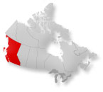
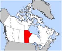
British Columbia
Day 1: (66.2 km) Vancouver to Mission's Rainbow Valley Trout Park
Our destination for the evening, Sun Valley Trout Park, is a former fish farm turned campground. Located 66 kilometres from Vancouver, the campground is an ideal first day ride; long enough to get in a good work out, but short enough that if we have kinks to work out in our bodies or bikes, we can still arrive before dark. A few kilometres east of the campground, on the west side of Mission, we will visit a large grocery store where we can pick up supplies for the evening... it is also my birthday today!
Day 2: (89.5 km) Trout Park to Hope's Coquihalla Campground
The fertile Fraser River Valley will continue to guide us as we climb slowly towards Hope. HWY 7 runs parallel to HWY 1, taking this route we can expect a pleasant ride!
We will pass Wenting's Cycle on the east side of Mission if we need a tune up. Our destination for the evening is Hope’s Coquihalla Campground. The campground is set in a forest and has campsites next to the Coquihalla River.
Day 3: (71 km) Coquihalla Campground to E.C. Manning Provincial Park's Lightning Lake Campground
Today’s ride is the most physically demanding of the entire trip (big climb for 18km!). We will have to stock up on groceries before we leave Hope as there are no grocery stores until we reach Princeton, 134 kilometres away. Our destination is Lightning Lake Campground in E.C. Manning Provincial Park.
Day 4: (92.9 km) Lightning Lake Campground to Bromley Rock Provincial Park
Today we will start cycling along the stunning Similkameen River, which appears shortly after Manning Lodge. We will enjoy the dramatic descent into Princeton, population 2 610. Grocery stores will be visible from the highway as we enter. If our bikes needs some love, we will head to Backroads Bike Shop. Princeton is the place to acquire supplies before continuing down the road to Bromley Rock Provincial Park. We will stop at Stemwinder Provincial Park. There are showers on site and campsites are picturesque, placed on the banks of the Similkameen River.
Day 5 - Combined with Day 4! : (115.3 km) Bromley Rock to Okanagan Provincial Park Total km: 200km!
Yay! Today we get to enjoy easy pedaling all day on the "mostly" downhill ride to Penticton. Although we can bypass Keremeos, population 1 289, we will consider checking out the charming town. Its name is derived from the Similkameen dialect of the native Okanagan word keremeyeus, meaning “creek which cuts its way through the flats.” Freedom Bike Shop is available for any repairs or supplies we may need. We will stay at either the South or North Campground in Okanagan Provincial Park.
Day 6: (95.7 km) Okanagan Provincial Park to Vernon's Swan Lake RV Park
The congested, noisy HWY 97 continues to hug Lake Okanagan as we cycle north towards Vernon. The first town we will cycle through today is Peachland, population 4 883. We will enter Kelowna by crossing the William R. Bennett Bridge, which spans Lake Okanagan. We will stop in West Kelowna to get our bikes tuned up by Rich at Sovereign Cycle then continue into Kelowna where we will stay with Deemo and Katie for the night!
Day 7: (100 km) Kelowna to Enderby
We left the city of Kelowna from city park heading north (Thanks so much Katie for dropping us off on route!). We rode the first 10km through the city of Kelowna (makes for some different scenery then we are use to!) As we near Vernon, population 35 944, we cycled along the shore of Kalamalka Lake and then up a large hill that separates you from the city of Vernon, then descended rapidly into the city where we went to the movie theatre to get some relief from the heat and watched TED!
Back on the road, we learned that the Okanagan Valley was occupied exclusively by the Interior Salish First Nations people until fur traders arrived in 1811. There were many signs to make it clear that this area was NOT a provincial park. We rested in Enderby where we went for a dip in the river! Refreshing... yet FREEZING!
Day 8: (140 km) Enderby to Revelstoke's Lamplighter Campground
Today we leave behind the sunny confines of the Okanagan Valley, biking first through the Shushwap Valley along the shores of Mara Lake towards Sicamous. We stopped at the local grocery store here and enjoyed this the town of Sicamous, population 3 192. The town is known as the Houseboat Capital of Canada. We continued on enjoying some flat terrain and incredible waterfalls to Revelstoke is a small mountain town on the shores of the Columbia River. The townsite is located just north of where the Illecillewaet empties into the Columbia and a short distance to nearby Mt. Revelstoke National Park. We appreciate this area for its natural beauty and opportunity for an array of outdoor pursuits including hiking, cycling and rafting in the summer.
Day 9: (152.3 km) Revelstoke's Lamplighter Campground to Golden Municipal Campground
Today we will take you through both Mount Revelstoke and Glacier National Parks. The park preserves many epic attractions such as the world’s only inland rainforest and ancient stands of old growth western red cedar. Glacier National Park was established in 1886. It covers 1,349 kilometres of mostly glaciated area. The Columbia Mountain range dominates the park, which is known for steep rugged slopes, a warm, moist climate and old growth cedar. Wildlife such as mountain caribou, mountain goat, black and grizzly bear call this area home.
Rogers Pass, elevation 1 330 metres, in the Selkirk Mountains, is the highest point on the impressive highway route between Golden and Revelstoke. Our destination for the evening is the Golden Municipal Campground, set tranquilly beneath the bows of towering trees but only seconds from downtown.
Day 10: (0 km) ha ha! REST DAY (due to weather)
Day 11: Golden to Canmore Wapiti Campground
Today we will leave Yoho National Park and cross the Alberta border into Banff National Park. Prime Minister John A. Macdonald created this park in 1885, to quiet claims over who was permitted to commercially develop the area. Macdonald originally set aside 26 kilometres around the hot springs and named it Banff Hot Springs Reserve. From this small park, Banff National Park was born. We will move your watches an hour ahead when we enter into Alberta and enjoy the easy downhill riding along the Bow River into Canmore! For almost a century, the town of Canmore was an important coal-mining town. In 1979, the last coal mine ceased operation. Shortly after the mines closed it was announced that Canmore would be the site of Nordic events for the 1988 Calgary Winter Olympics. This breathed new life into the small mountain town and was instrumental in helping Canmore transition from a small industrial town to its present state as a world-class tourist destination.
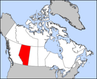
Alberta
Day 12: (90.5 km) Canmore Wapiti Campground to Calgary Mom & Tony's House!
We will be watch the horizon open up this-morning as we leave the mountains behind us. The road to Calgary has two and sometimes three lanes, always with a massive shoulder. The first settlement that we ride through is Deadman’s Flats, a small village just east of Canmore. The origin of the name comes from two Aboriginal people who were hunting in the area that was at the time a national park, when they saw Park Wardens approaching. Knowing that hunting in the area was illegal, they smeared themselves with the blood of the dead beavers and played dead.
We will climb up Scott Lake Hill to an elevation of 1 410 M and then race down the other side of it and enter the prairies! If its a clear day we will see Calgary for... ever, with a population of 988 193, the city sits at the convergence of the Bow and Elbow Rivers. It was at this merging of waterways that the North West Mounted Police built a fort to protect the area’s fur trade and to stop U.S. whiskey traders from entering the western plains of Canada in the 1870s.
Day 13 & 14: (0 km) Rest day
Visit with Mom and Tony & check out the Calgary Stampede!
Day 15: (154.2 km) Mom & Tony's House to Bassano Campground
Weather will play an important role in how we remember today. With a west-wind, we will cycle effortlessly, watching serene farmland blur by. If the wind is in our faces, this stretch will be truly challenging. After cycling over the mountains we will undoubtedly be in good physical condition. The battle with wind is not so much physical as mental. Whatever happens, we will remember how lucky we are to be here!
The first town to pop up out of the prairie is Chestermere, population 11 262. Chestermere is centered on Chestermere Lake, which was created in 1906, by damming the Kinniburgh Slough and diverting water from the nearby Bow River. Next is Strathmore, population 11 335. Strathmore sprung up as a stop for the CPR trains heading west to the mountains. It now serves as an agricultural hub for the nearby farmlands. Gleichen has a few small stores and 2 exits allowing you to visit the town and return to the highway with little backtracking. Our destination is the Bassano Campground, located centrally in Bassano and run by the town.
Day 16: (155.4 km) Bassano Campground to Medicine Hat's Gas City Campground
Today is another long day of cycling across flat prairie. We will make sure that we have plenty of liquid as there are long distances between towns. There are virtually no trees in the area to block the sun and wind. We will pedal first into Brooks, population 12 498, which is known as “The City of 100 Hellos,” due to the diverse global population that comes to work in the local agriculture industry. Medicine hat lies at the intersection of HWY 3 and HWY 1 on the banks of the South Saskatchewan River. The name Medicine Hat comes from the Blackfoot word for the eagle tail feather headdress worn by medicine men. The city is known for its vast energy resources, especially natural gas. We will hit up Cycle Path here to get our bikes tuned up! The Medicine Hat Gas City Campground is a city run campsite on the west outskirts of the city. This campground is a popular place during summer months. Laundry facilities and a small convenience store are available on-site YAY!
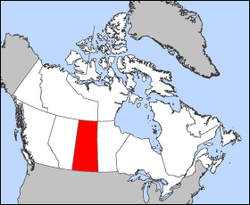
Saskatchewan
Day 17: (91.6 km) Medicine Hat to Eagle Valley Campground
We purchased supplies before leaving Medicine Hat. The road to Eagle Valley Campground is desolate and lonely. Midway through the day we crossed the border of Alberta and Saskatchewan.
Our destination for the evening is Eagle Valley Campground, an oasis located just off of the highway. The campground is Caribbean themed and the owners are friendly. The entire campground is serviced with free wireless internet and laundry facilities are on site.
Saskatchewan is the only province in Canada that does not practice daylight savings time. Between March and November, clocks in the province of Saskatchewan will be the same as the province of Alberta. From November to March Saskatchewan clocks will be the same as Manitoba.
Day 18: (78 km) Eagle Valley Campground to Gull Lake
Early in the day we had a peek at the distant Cypress Hills which rise to an elevation of 1 468 M. The hills form a drainage divide separating rivers that drain to the Gulf of Mexico and those that drain to Hudson Bay. The highway shoulder deteriorates and there are barbed wire fences that run parallel to the highway for birds. Gull Lake, a small agricultural town at the intersection of HWY 1 and HWY 37, is home to giant wind-turbines that can be seen from a distance. It is a tease while cycling through the prairies because you can see the next town for 15 or more km.
Day 19: (235 km) Gull Lake to Moose Jaw
The prairies have a beauty that cannot be adequately described through words or pictures. One has to pass through the rolling fields of wheat, enjoying panoramic views and miles of emptiness, to gain an appreciation of it all.
The ground in this area is rich with deposits of Sodium Sulfate. Don’t be surprised if you see a white film in the ditches or on the horizon. Sodium Sulfate is harvested using an evaporation process that separates the Sodium Sulfate from water. The result of this proccess is a product used in industrial applications like the manufacturing of detergents.
Chaplin Lake is designated by the Western Hemispheric Shorebird Reserve Network because it is vital bird habitat. Chaplin Lake is Canada’s second largest saltwater lake. 67,000 birds have been counted in this area in one day. Birds flock to this area to feast on shore flies, brine shrimp and seeds from the shallow, salty water. Many birds use this area as a link between their winter home in South America and their nesting grounds in Canada’s north. Some birds fly for over 70 hours without a break, making this stop a much-needed rest area.
Moose Jaw is a must stop. Stay at the Prairie Oasis for their indoor pools, hot-tub and water slide!
Day 20: (150 km) Moose Jaw to Weyburn
Day 21: (116 km) Weyburn to Carlyle
Day 22: (100 km) Carlyle to Pipestone
Day 23: (201 km) Pipestone to St. Claude
Day 24: (St. Claude to Winnipeg
Matitoba
Day 19: (114.1 km) to Rainbow Beach Provincial Park
Day 20: (135.6 km) to Arborg and District Multicultural Heritage Village
Day 21: (105.3 km) to Selkirk Municipal Campground
Day 22: (142.6 km) to Caddy Lake Campground
Day 20: (135.6 km) to Arborg and District Multicultural Heritage Village
Day 21: (105.3 km) to Selkirk Municipal Campground
Day 22: (142.6 km) to Caddy Lake Campground
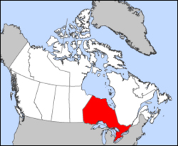
Ontario
Ontario
Day 23: (68.5 km) to Kenora's Anicinable RV Park & Campground / Scott Green's House?
Day 23: (68.5 km) to Kenora's Anicinable RV Park & Campground / Scott Green's House?
